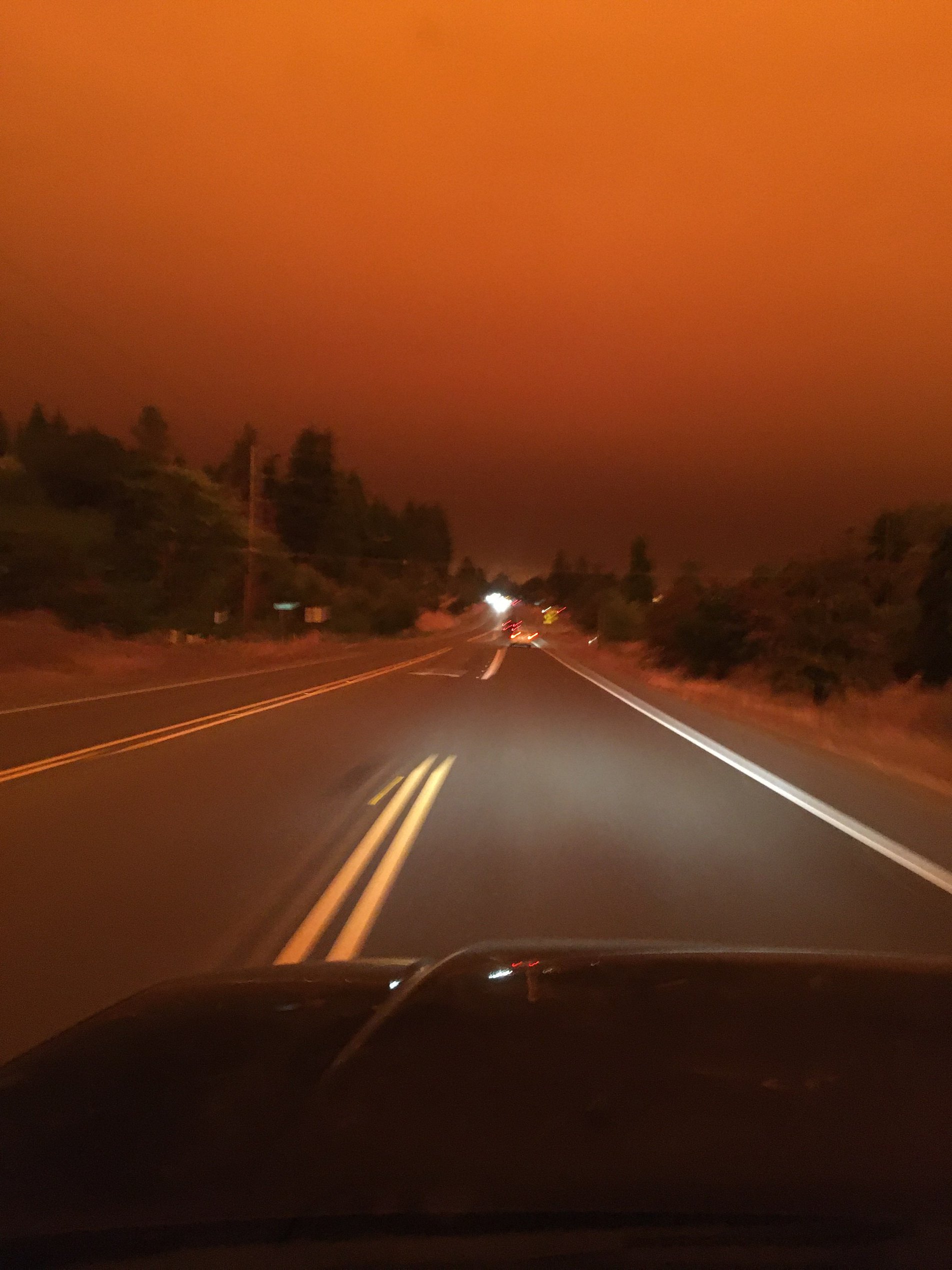
Fir Crest today at 4:30. Ominous but high up.
Whistling Ridge at 2:30
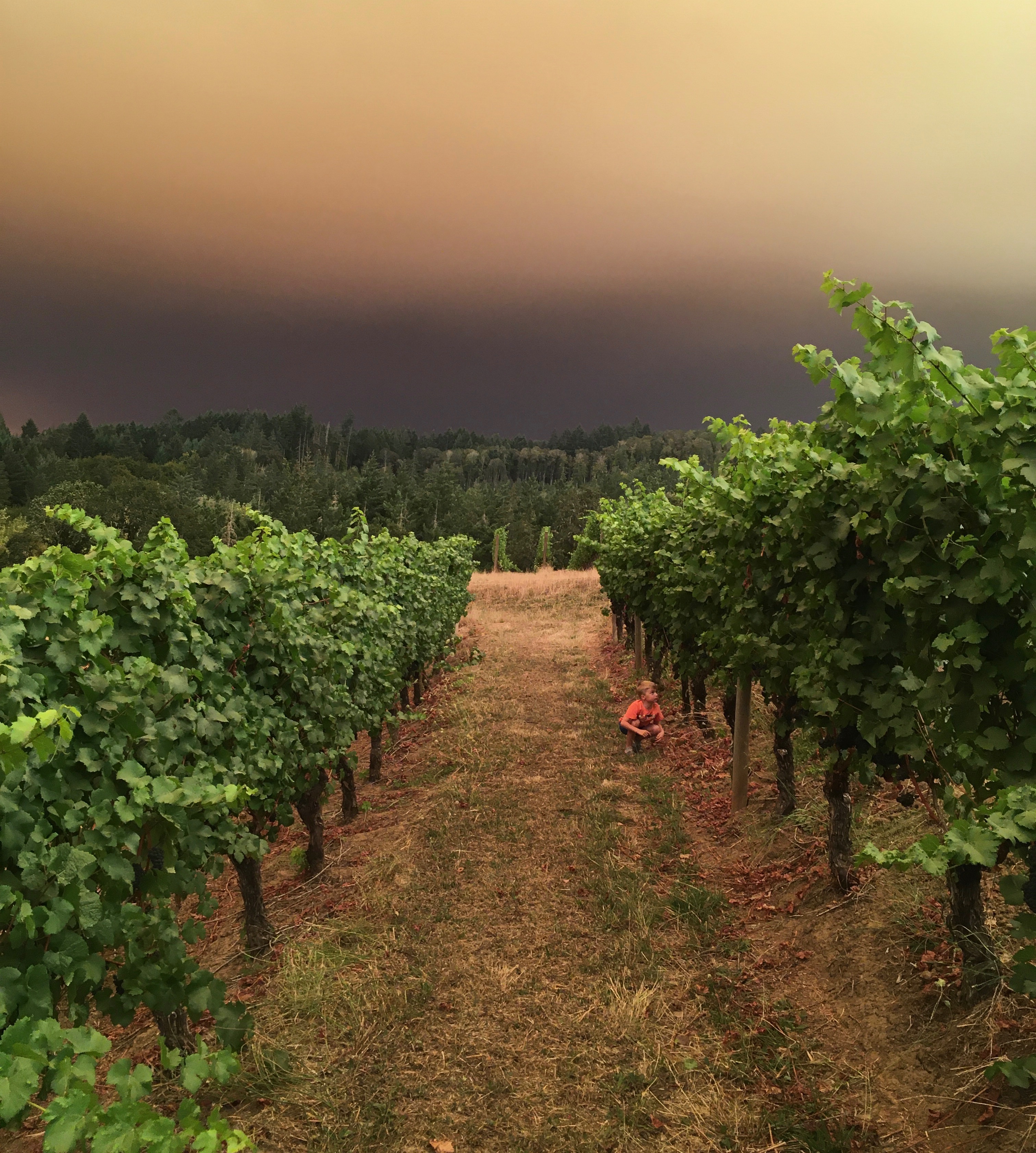
Durant…
McMinnville is a bit smokey tonight, and I hope that everyone outside of town is safe and well. There are a number of smaller fires in the Valley now, but these are being actively combatted.
Scary times. The year that keeps on giving. Stay safe.
you mean in altitude rather than in quantity?
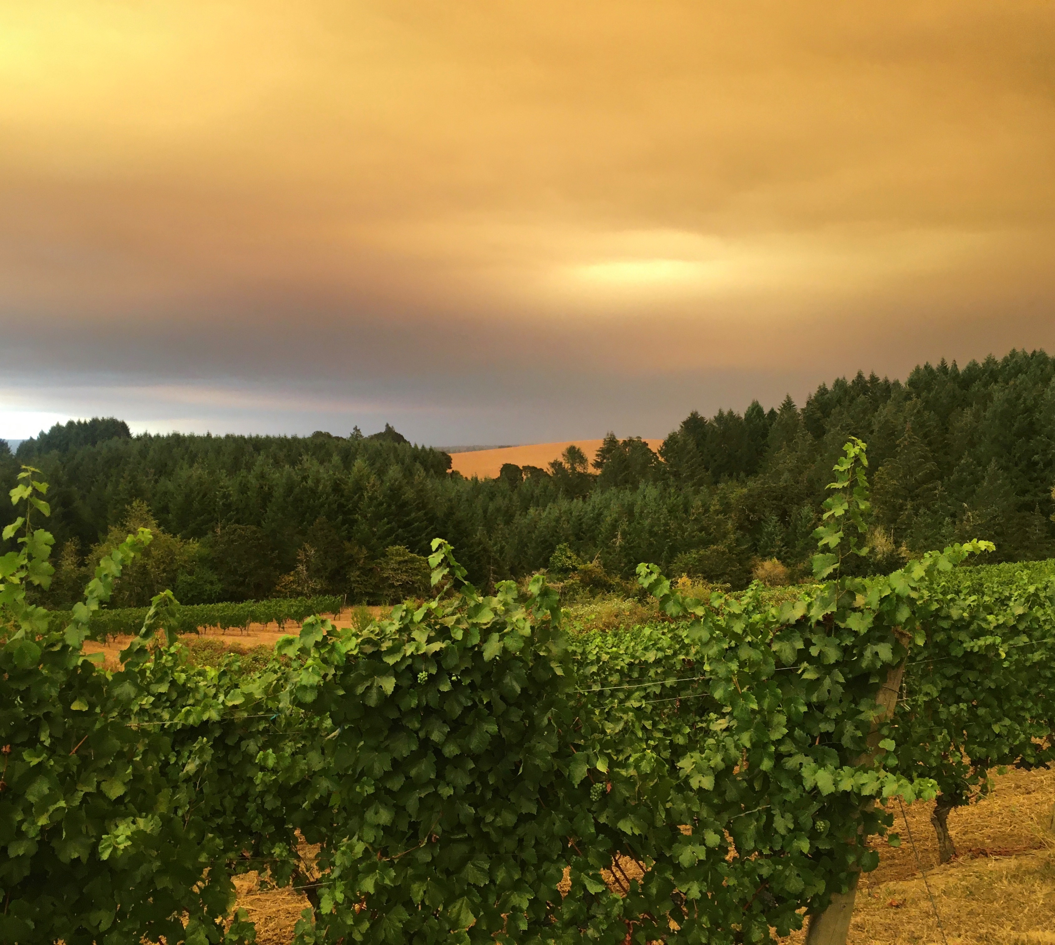
High up. For the most part, depending on where you are, you can’t smell anything. Even at the winery yesterday it wasn’t really smoky despite the way the skies looked. That being said on the way here a fire burning up over the top of Mountain Top Rd. north of Newberg and probably in Cornelius/Beaverton/Hillsboro (I’m not sure where it actually is) was sending smoke cascading down the south side of the hill and a mile wide swath of North Valley Rd about 5 miles East of the winery was pretty heavily smoked. I would imagine that means that thing is still burning.
stay safe Jim, we’re on pins and needles not far from you over here in Banks, the air quality is awful, and I keep seeing evac notices for very close neighboring communities. Scary times for sure.
6:45 AM. Fire burning over the top of Chehalem Mountains. Heard from folks on the other side that looking up at it last night it looks like Mt. Doom.
8:00 AM and it’s nearly pitch dark still at the winery. Processing fruit outside and need the bright overhead lights on to see what’s going on.
Yes, high up. And as Jim noted, on the ground it hasn’t been much(at least West side of the valley).
It took me a bit to figure out why Todd’s post about the smoke being unlike anything in Yamhill county before didn’t seem right. But when I was a kid they were still burning the fields every September, and that was way, way, worse for smoke. Not the worry that the forests burning is(I am old enough to remember the effect of the Tillamook burn on Oregon’s collective consciousness but not the fire itself).
But the field burning always created a horrific low level haze that was just awful to breathe. I hated it every year and am glad the practice has gone by the wayside.
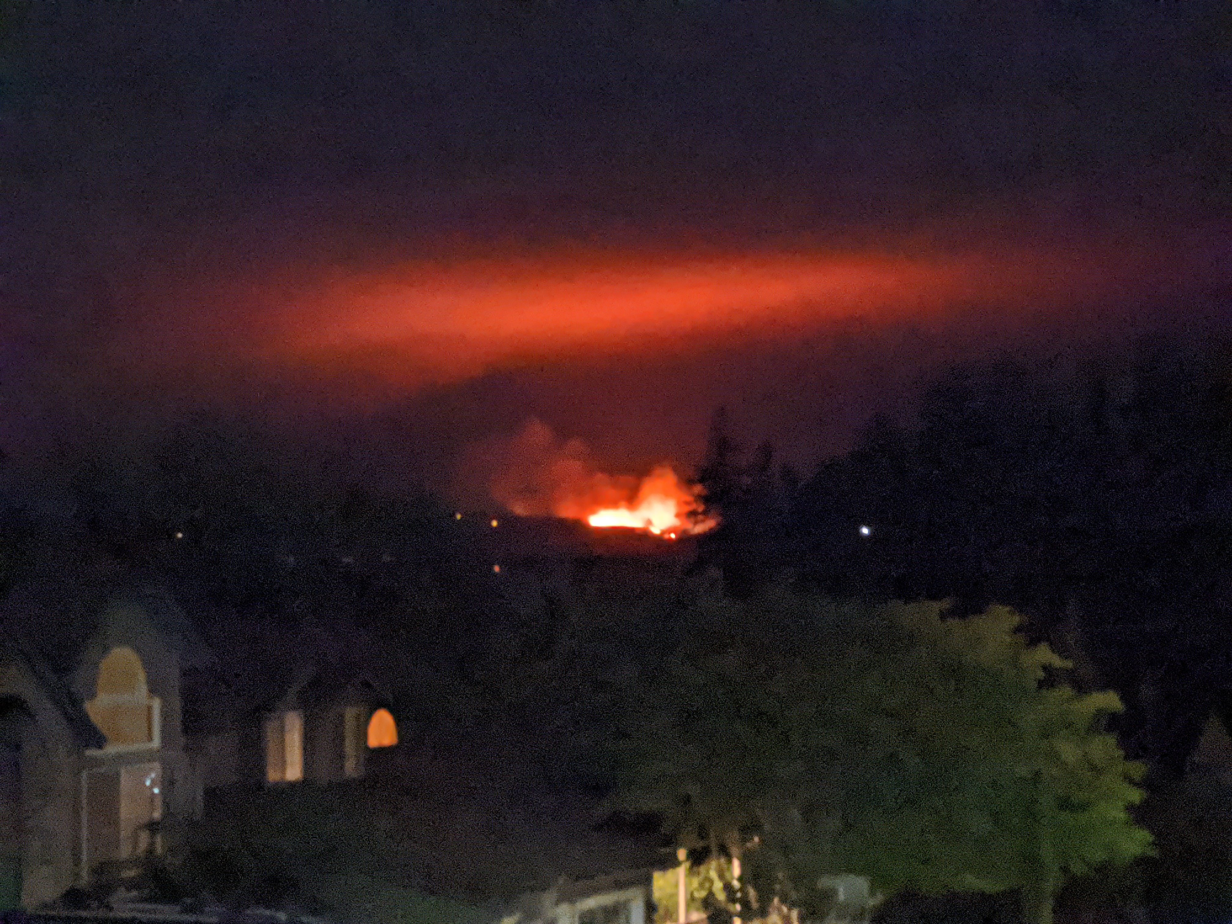
Also-seems like the Chehalem fire is contained for the moment. That’s from the map and from a friend on Bald Peak.
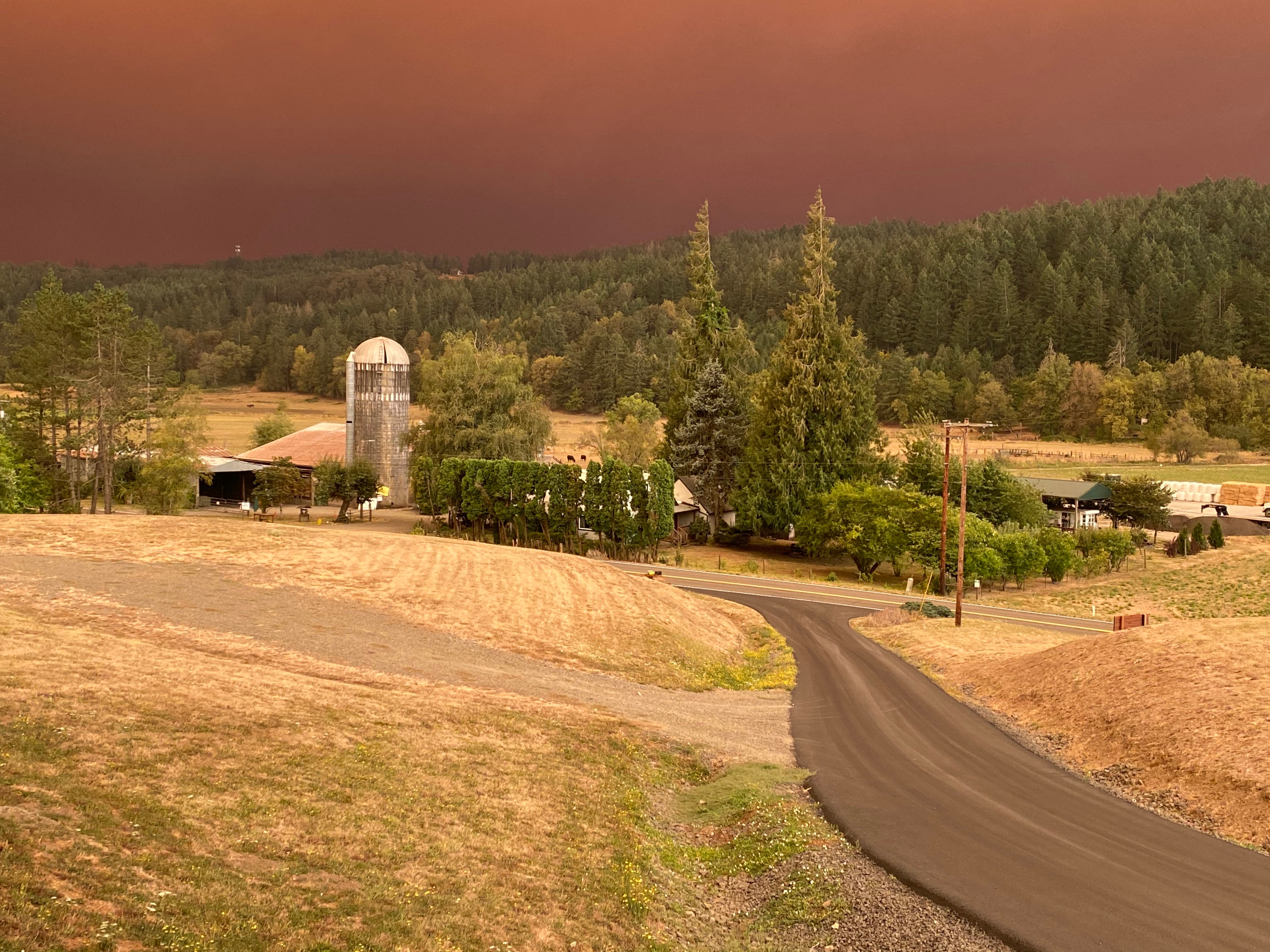
this is north of Corvallis yesterday at 9am from my friend.
Smoke in south Beaverton this morning, so I didn’t go for my usual morning run. Not suffocating but I still don’t need all of that in my lungs. My shop superintendent was evacuated from Bald Peak last night. Huge brown clouds to the south and west of Beaverton in the early evening, like a giant slice of pie out of an otherwise clear sky. Pretty spooky.
Is that different than controlled burns to help prevent these big forest fires? Sounds like you’re describing something that’s more of a farming practice than fire control measure? Or was it both? ![]()
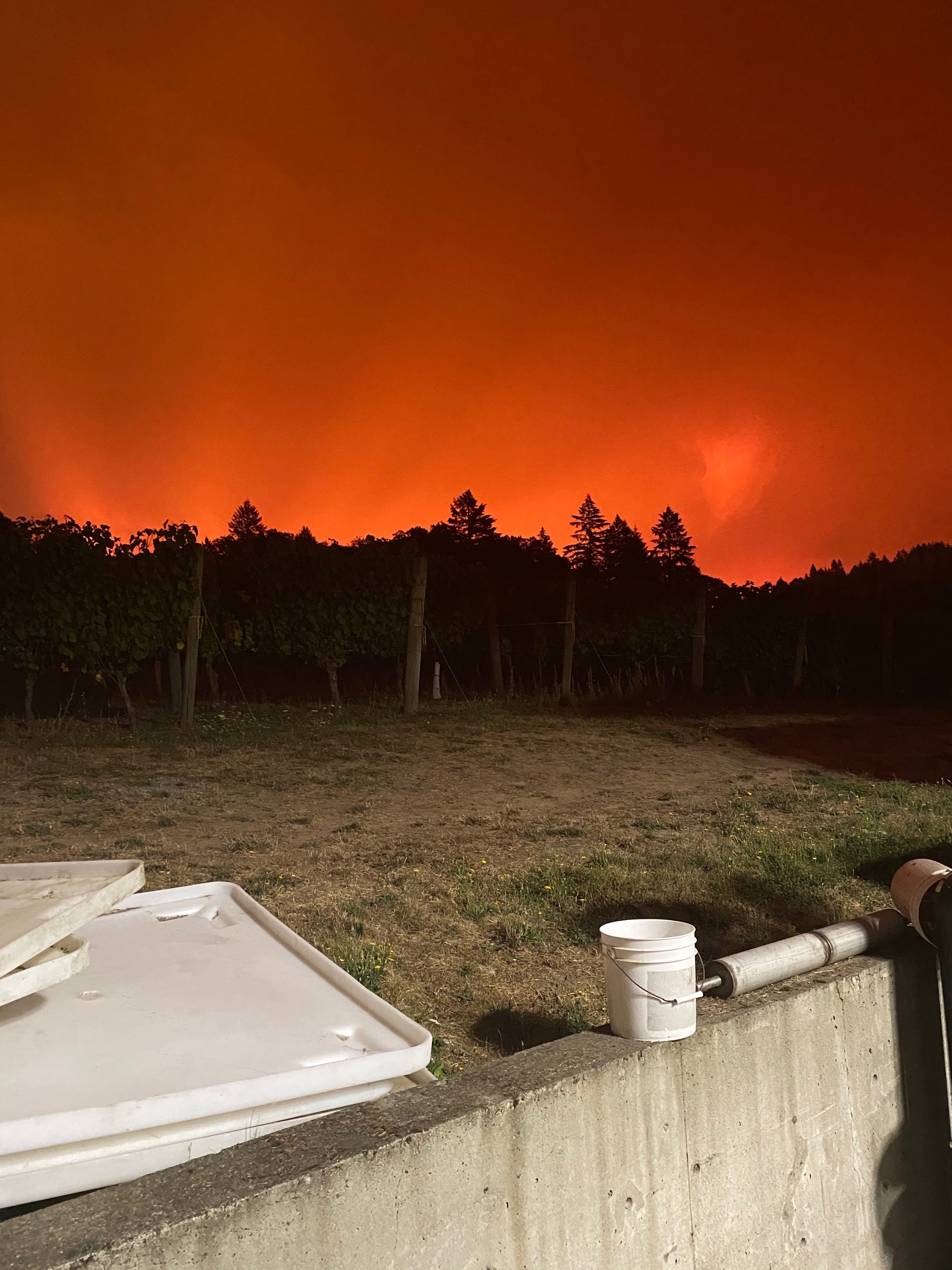
Here’s a bad photo of the Chehalem Mountains from my house, about 10 miles west, about 9 pm last night. It got bigger around 10, and then smaller around midnight, but I didn’t take another picture.
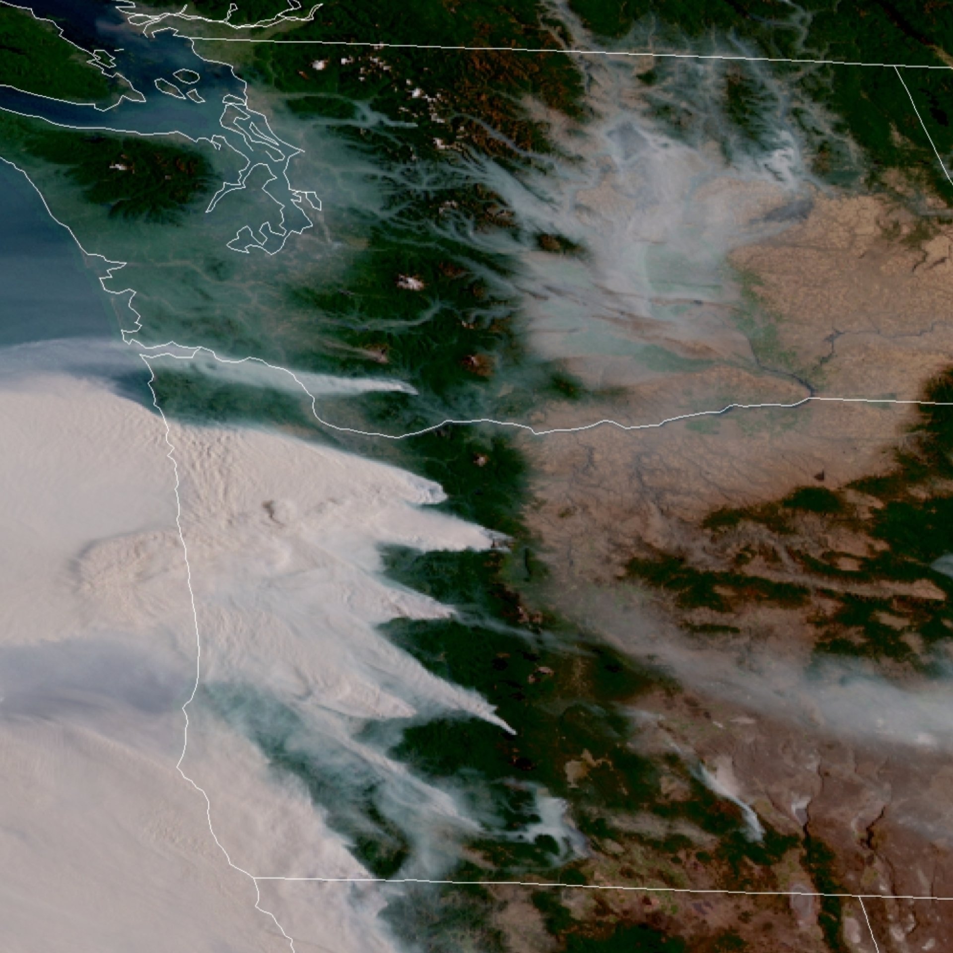
Here’s the current NOAA GOES shot of Oregon:
Our wind typically comes in from the west, but the past week it is from the east, which tends to happen for a week or two this time of year.
Chinook winds = Indian summer
bad when the place is burning though
Seems like the Chehalem Mountain fire is abating as it is starting to lighten up both in terms of daylight and smoke intensity to our northeast. However to the Southwest it looks darker and more intense now. Feel like the wind is starting to turn as well.
So what’s the latest on risk of smoke taint? Anyone picking “prematurely” to avoid the smoke?
I think in most areas the risk is still minimal. I’m reading a VERY thorough publication out of Australia with tons of links to papers and studies on every aspect of the topic.
Just spoke to people at Bethel Heights. They described it as quite scary, like the twilight-zone.
RT
Hate seeing these pictures and hearing first-hand how scary and dangerous this is for people. I just got back from ten days in Oregon, and was very lucky to not experience much of this. Hope everybody out there makes it through, winds die down, rain comes, all of it.