Thx, I’d guess 3,4,8 and the tee box on 9 are most impacted. Hopefully it comes out fine. That place is special and love playing whenever I’m in the area.
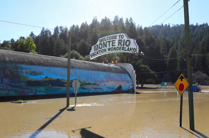
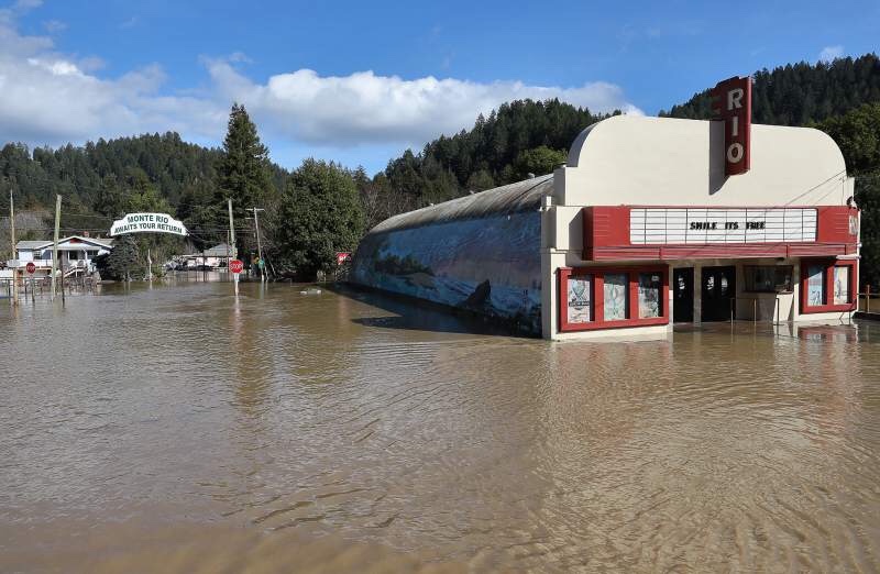
Downstream in Monte Rio proper but this should give some perspective to the water level up at Northwood.
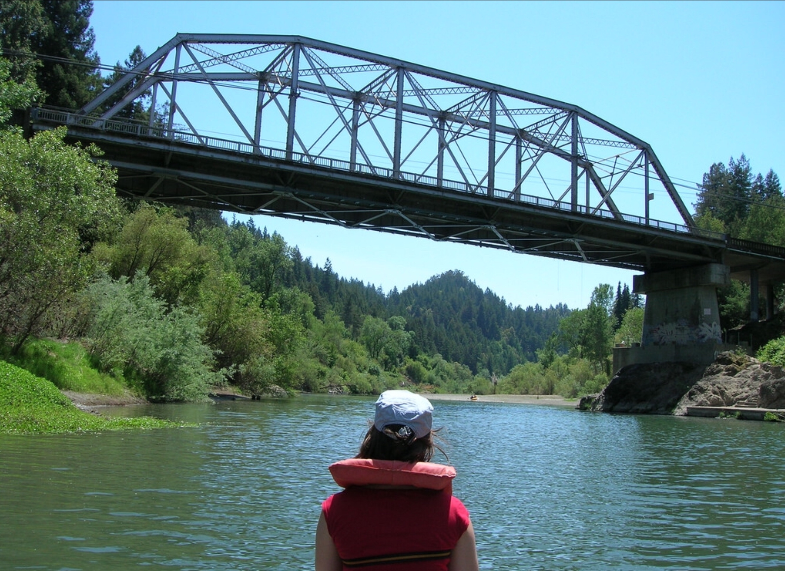
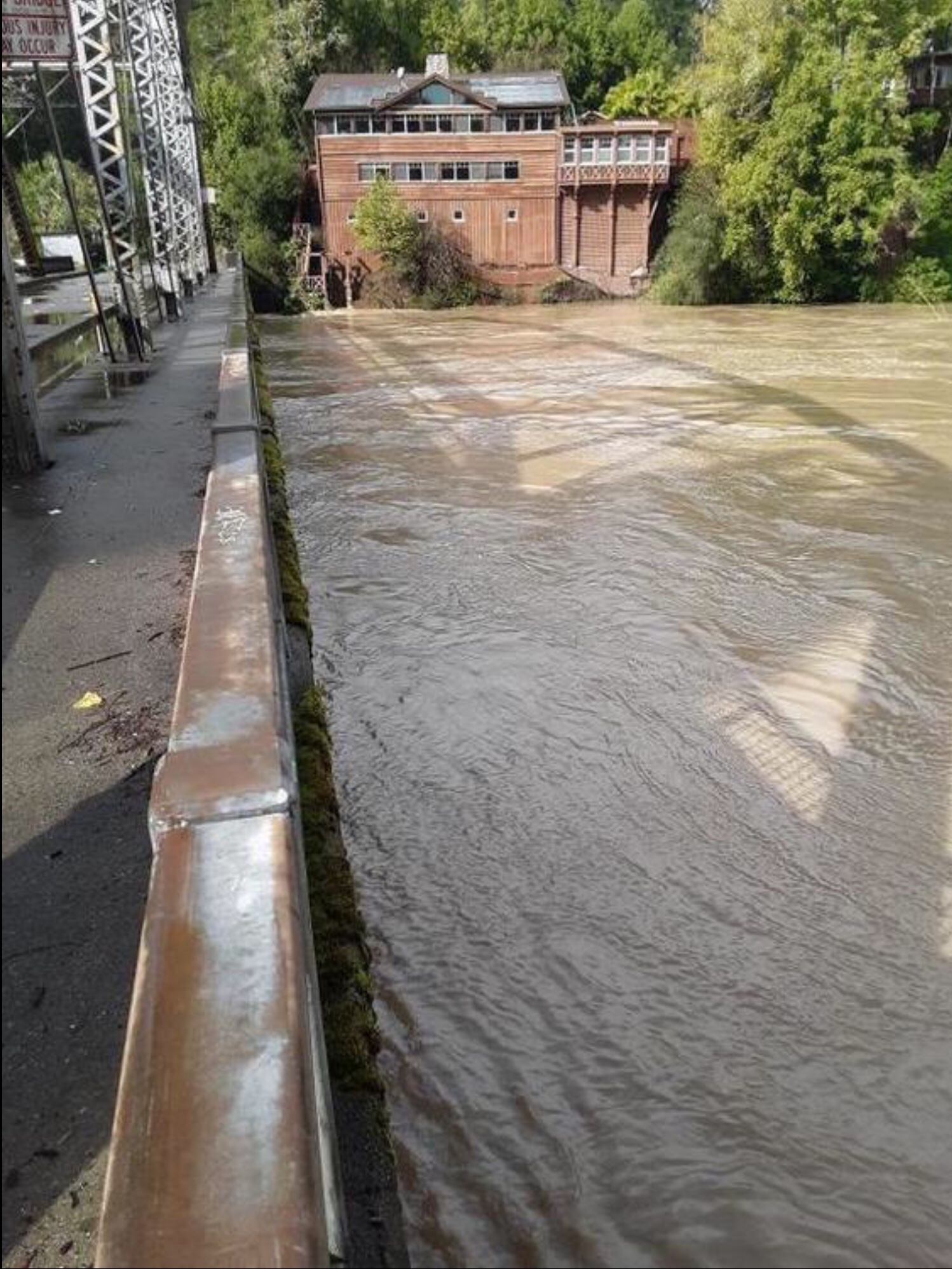
Summer vs Flood ay the Hacienda Bridge in Forestville.That’s a lot of water.
There is an element to why the Russian River floods that many people don’t know about. The river flows from way up in Mendocino down to the Pacific ocean and that is where the problem is. The Pacific tides come in and out. When there is heavy rain and the river starts to rise flooding can occur when the Pacific tide “comes in” and essentially dams the Russian River causing it to rise and eventually spill over its banks.
When there is SEVERE rain, like the storms this week the problem is the same but the instead of more localized flooding it becomes widespread.
Remove the tidal surge (I know that’s impossible) and the flooding would decrease dramatically. That is why Brian’s photo of the bridge is so dramatic. Tremendous amounts of water flowing down the river hitting the resistance of the incoming tide. The river can only rise and eventually spill over and flood.
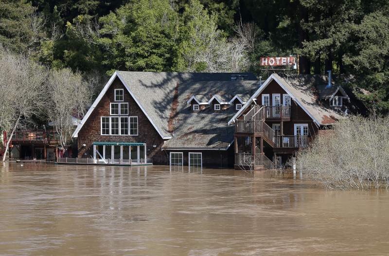
Hoping that the Guerneville - Monte Rio can get back to normal ASAP.
Tom
That flow at the Hacienda bridge was about 17,000 cu/ft per second or 1.65 acre feet per second.
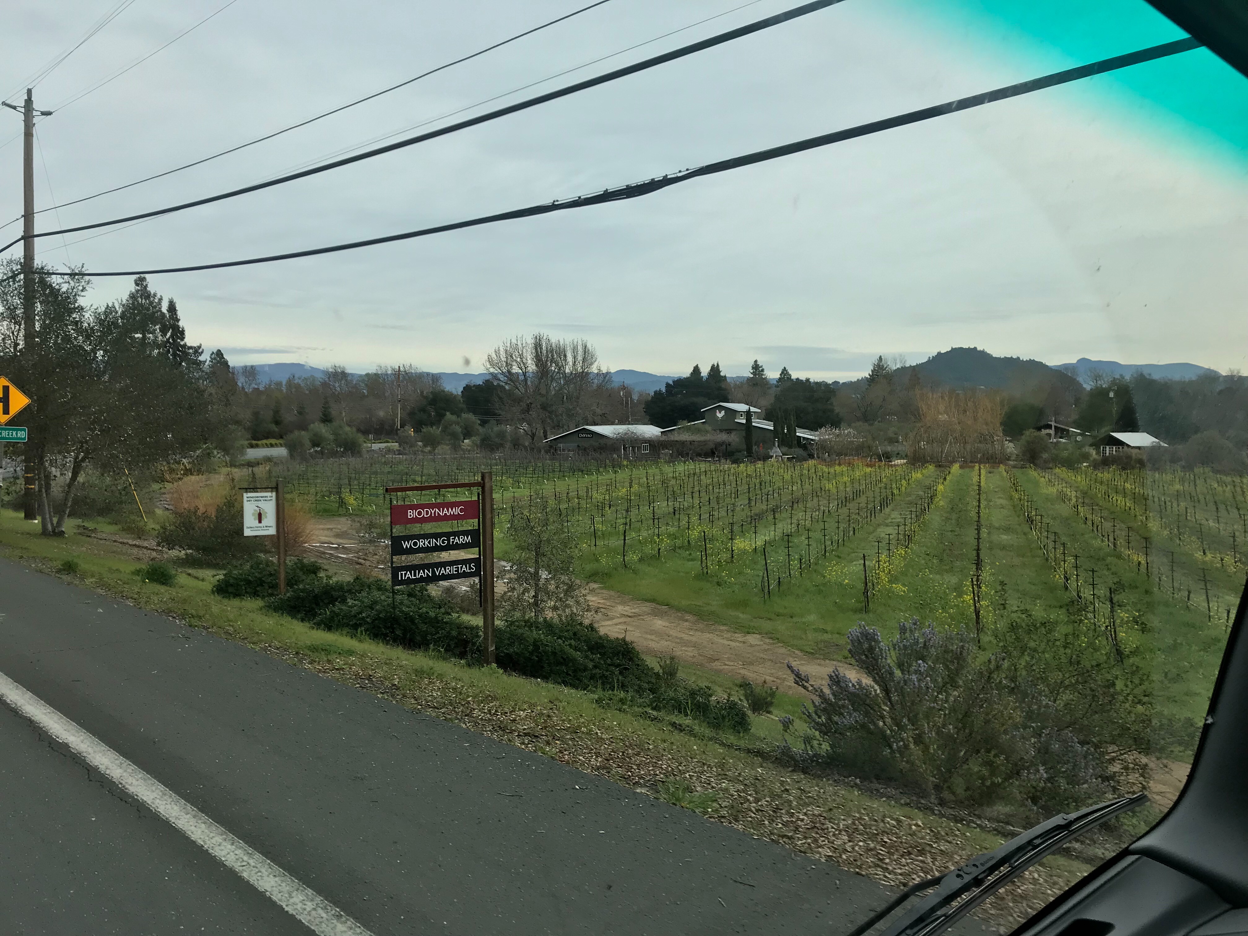
Passed by DaVero a little bit ago. The soil on the roads through the vineyard is dry.
Tom, I don’t think this is true, at least not once you’re a mile or two up-river. Certainly not a factor far up-river in Guernville. Flooding there occurs because there is a large drainage basin feeding the river up stream, a lot of local hills surrounding the river collecting rainfall (in this particular storm some nearby locations hit as much as 20" in a 48 hour period, to give some indication of how much rain there was), all having to flow down to the river, then through it’s narrow path between hills on both sides. Guernville is about 56’ above sea level, tides in recent days have been about 6 feet max, that’s really not a factor.
When we visited the Bodega Marine Laboratory in Bodega Bay last year a visitor asked a question about flooding in the area during 2017. The official brought up the effect that the tides had on flooding, especially coastal floods and flooding of the Russian River.
I don’t know the actual geographies of the area and how it contributes to flooding, just relaying what an official at the BML told us.
Tom
I was curious if any wine inventory was lost in the winery floods.
A cave sounds great until there’s a flood and it turns into an underground lake.
Couldn’t tell from the drone footage if KB facility was flooded or not and I don’t know how accurate the interactive flood map is, but the map shows that flooding in the Barlow area of Sebastopol extends west to about Taft Street, which is a good two blocks west of where Kosta-Browne is located on Morris. They were just getting ready to start shipping appellation wines in a couple of weeks.
Good to see you are high and dry sir!
I drive right by KB and the rest of the Eastern and Northern Barlow on my way home. Today there were lots of people at KB washing kegs. The building 5ook on maybe a foot of water. I would assume that they have their wine in cold storage offsite. Along Laguna Pkwy it was like a ghost town. Most everything to the north is on higher ground. Taft St is behind the police dept and that didn’t get any flood. It stopped at Pax as the Distillery next door is up higher as well.
From Pax today.
They taught us the same thing in college during the 97-98 El Niño. We had to do a case study on the Russian that basically had the same conclusion. Tides have a tremendous amount of power. The Columbia River tidal influence goes up to the Bonneville dam which is over 146 miles from the ocean. It’s interesting when you see the Willamette slow down in the spring when you’re in downtown Portland. I’ve been on the anchor in my boat and swung completely around while fishing.
Facebook has had a good number of before, during and after pics that show the flooding, the clean up and the spiffy clean results. There has been some outstanding clean up efforts in Guerneville.
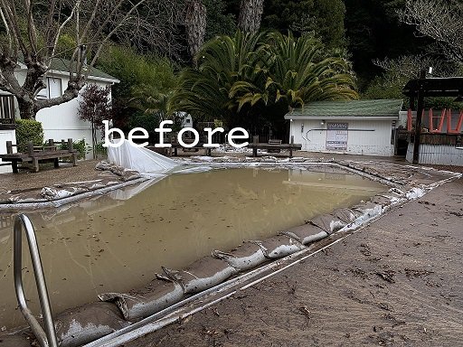
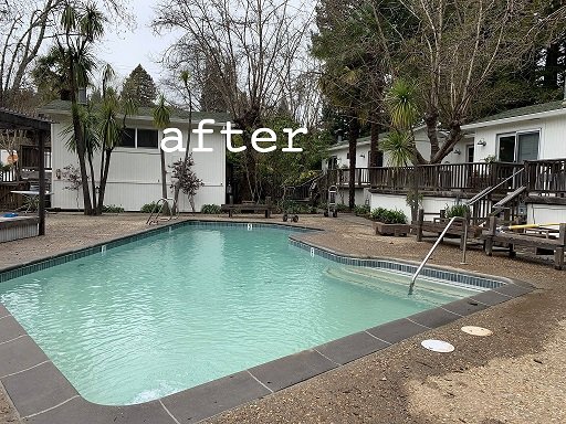
Wow! That looks like they flipped the before and after pics. Do you know who’s yard that is?
I never understood why people would continue to live in areas that get flooded every 3-5 years.
There are no palm trees in Guerneville Randy. River just went below flood yesterday, there is no way anyone cleaned up that quickly.
Cheap rent. Seriously though, if you live there it’s the best place to live in the Summer but the worst place to live in the Winter. All the homes along the river were traditionally Summer vacation rentals that were unoccupied in the winter months. Most of the year round homes have been raised up 1 to 2 stories above flood. They make apartments out of the lower floors and rent them.After the ‘95 flood most insurance companies would not cover a home thatw as not raised. There was a big push then and lots of homes were lifted.
The major floods come in a 10-12 year cycle. In the nearly 30 years I’ve lived in Forestville the river has hit flood stage more than a dozen times but homes do not get inundated until the river rises up another 8 feet. This year and in 4 previous winters it has gone up 8-13’ above flood. It’s a way of life. People stock up with food and drink and have block parties. Canoe back and forth and watch homes of neighbors who evacuate. Aside from the 1,000 or more homes that flood tyere are 5,000 more that are up above the flood and just flooded in.
Based on Instagram posts it looks like Barlow was hit pretty hard. Appeared that Pax/Wind Gap was throwing a lot of wine out.
Reports of any others?
KB took on way more water than Wind Gap but it’s a production facility not cold storage. Haven’t heard amything about losses at Wind Gap. Couldn’t be too bad they only took on a foot of water. That’s the bottom level of a palate if they even store their wine in house. 11 cases per palate that got wet.